
AcATaMa
AcATaMa
The AcATaMa is a Qgis plugin for Accuracy Assessment of Thematic Maps.
Thematic Map
The thematic map is the raster layer that you want to quantify the quality of the data through the accuracy assessment protocol. It must be a layer with categorical values with byte or integer as data type with a specific pixel-value/color associated, otherwise AcATaMa will prompt the user to apply an automatic pixel-value/color, but this is temporal (unless you save it, see below).
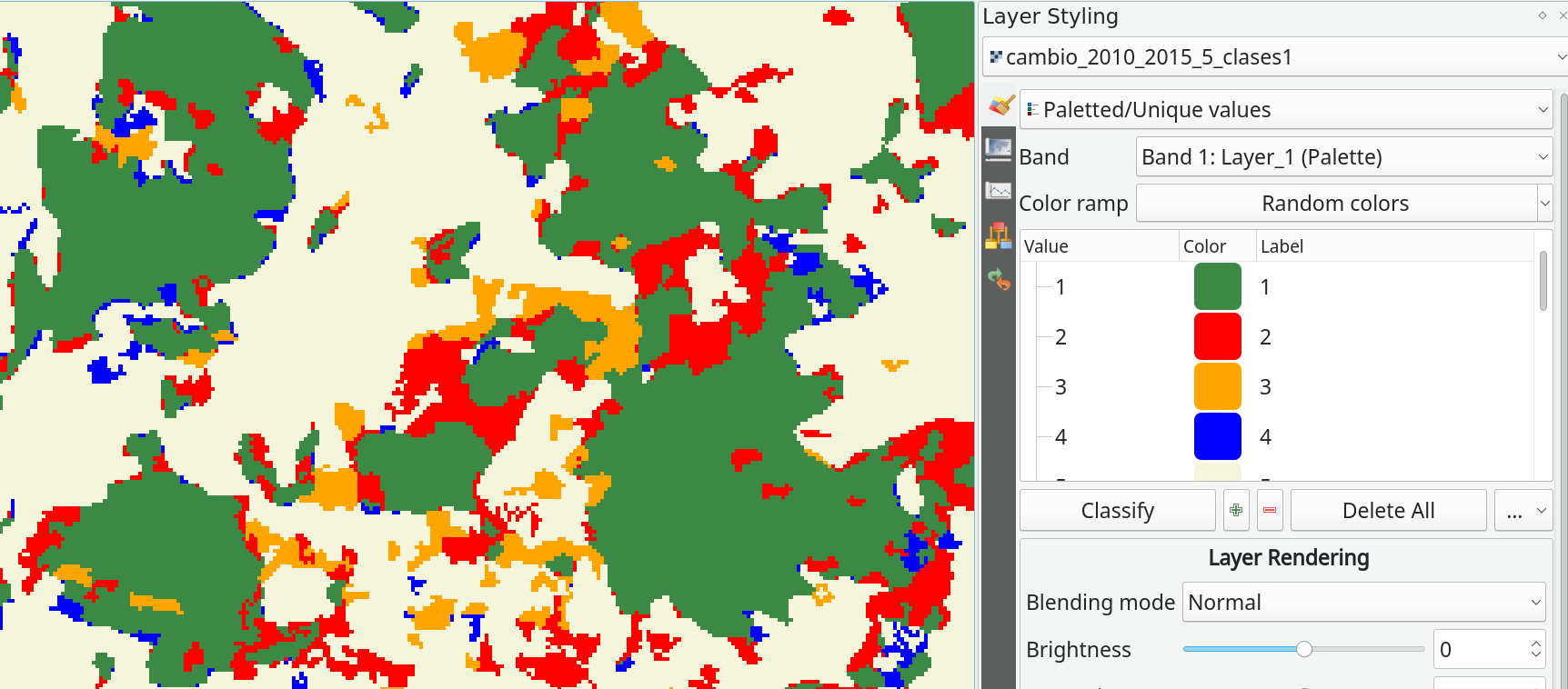
There are two types of pixel-value/color associated accepted in AcATaMa (based on Qgis):
- “Singleband pseudocolor”
- “Paletted/Unique values” (recommended).
TIP!
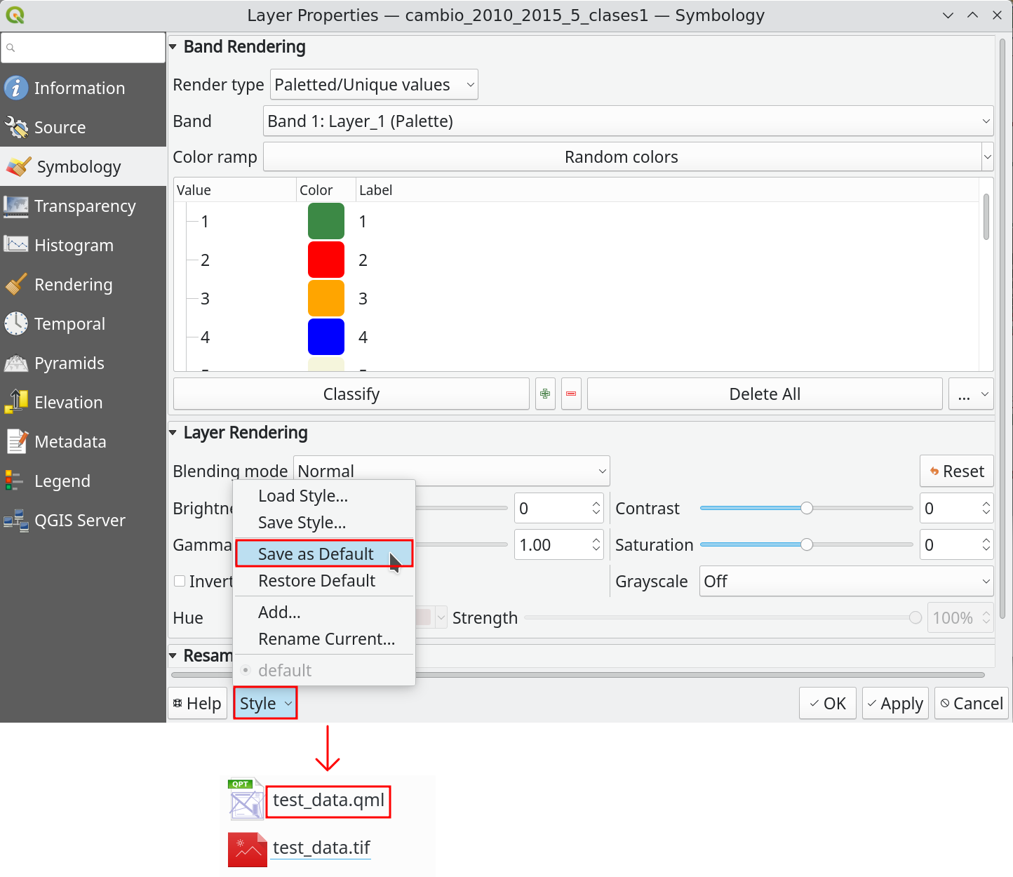
If the layer don’t have the color table as a metadata inside the file, we recommend set and save the pixel-value/color associated for the Thematic Map before work with it, you can save that style using the Qgis xml style file (see below) or saving the Qgis project.
IMPORTANT!
Clip the thematic map in your area of interest could be very important for the sampling design and the accuracy assessment process, because the area by classes changes and some parts of AcATaMa depends on it.
Next » Sampling Design